story maps
My mother was a cartographer so it was not too much of a leap for my illustrative curiosities to lend towards map making. My maps tell stories and create celebratory connection to landscapes, towns, events, and cause based campaigns.
Roaring Fork and Farms Local Food Guide


Dolores River Canyon Country: a conservation map

Snowmass Village Visitor Map and Brochure


Snowmass Village Visitor Map, commissioned by Snowmass Tourism, 2021. www.gosnowmass.com
Central Oregon Visitor Guide
Aspen Valley Hospital network of care maps and artwork

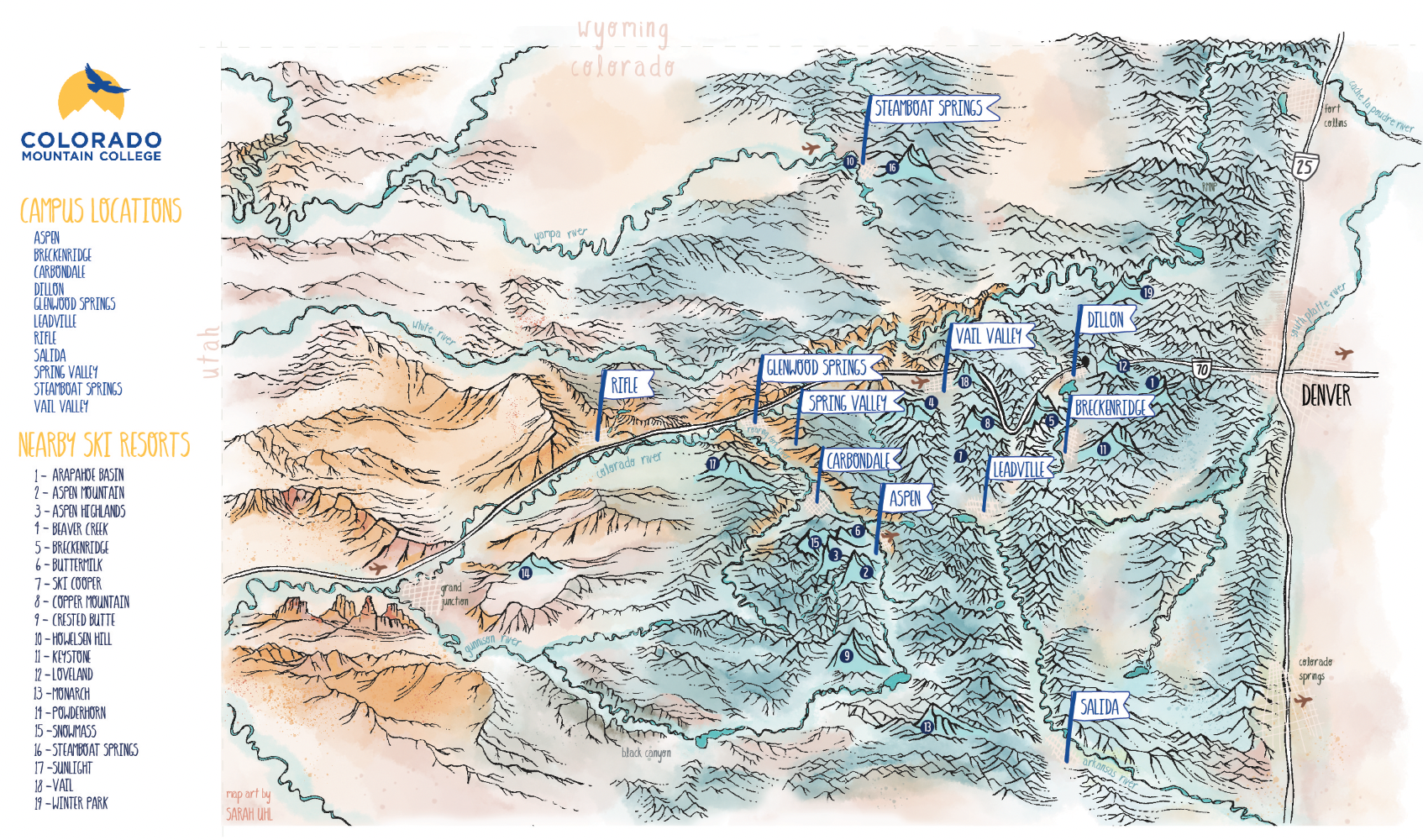
Colorado Mountain College Campus Location Map
2018 Impact Report for CORE


Aspen’s Community Office for Resource Efficiency commissioned this illustrated map to help bring life to their Annual Report. The Annual Report was printed as a 8.5 x 11 inch trifold brochure that opens up to an 11 x 25.5 inch inside spread. The map and my various illustrations showcase the organization’s accomplishments over the past year as well as our iconic landscape.
Roaring Fork Watershed Storymap. Commissioned by the Roaring Fork Conservancy August 2018, an organization that works hard to protect our watershed by keeping water in local streams, monitoring water quality, and preserving riparian habitat to ensure healthy rivers in the Roaring Fork Valley. Copies of this map are available for purchase in my shop. Your purchase includes a $25 donation to RFC which will go directly towards local river research, education and conservation efforts!

My friend Jen asked me to create a map of the world so her family could follow along with a sailing and photography journey in 2017.

Map of Oakland. Commissioned by REI for a story about nature prescriptions. Read the story here: https://www.rei.com/blog/news/a-dose-of-the-outdoors
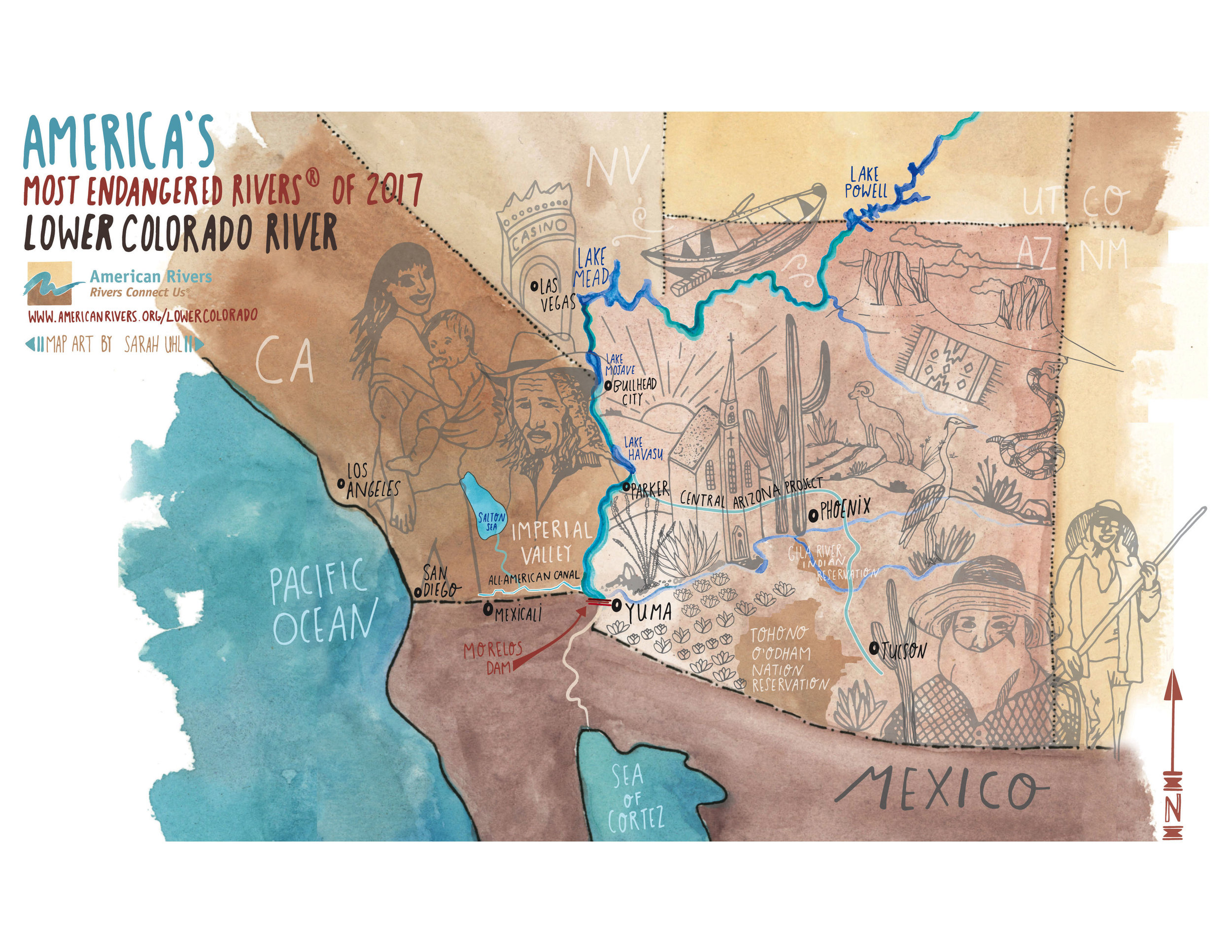
America's Most Endangered River Report. Comissioned by American Rivers April 2017. Read the story here: https://www.americanrivers.org/endangered-rivers/lower-colorado-river-az-ca-nv/

Aspen Ski Co commissioned two maps of the ski resort and the town when they hosted the 2017 World Cup Finals.
Outdoor Research comissioned this map of the US for their trade show booth display in 2016. They will be using the print on a few new products in 2019.

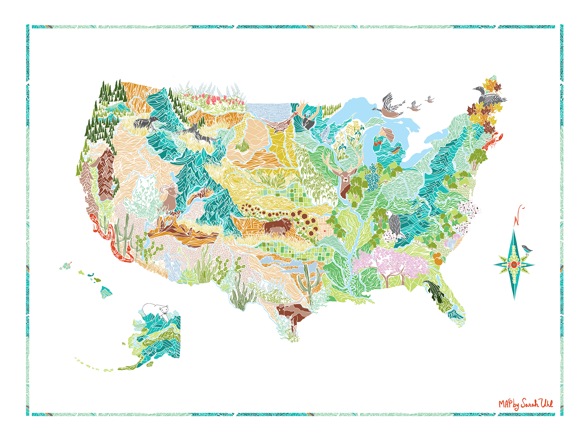
The American Alpine Club commissioned a map of the US for their annual membership report, showing off the top areas to climb in our country.

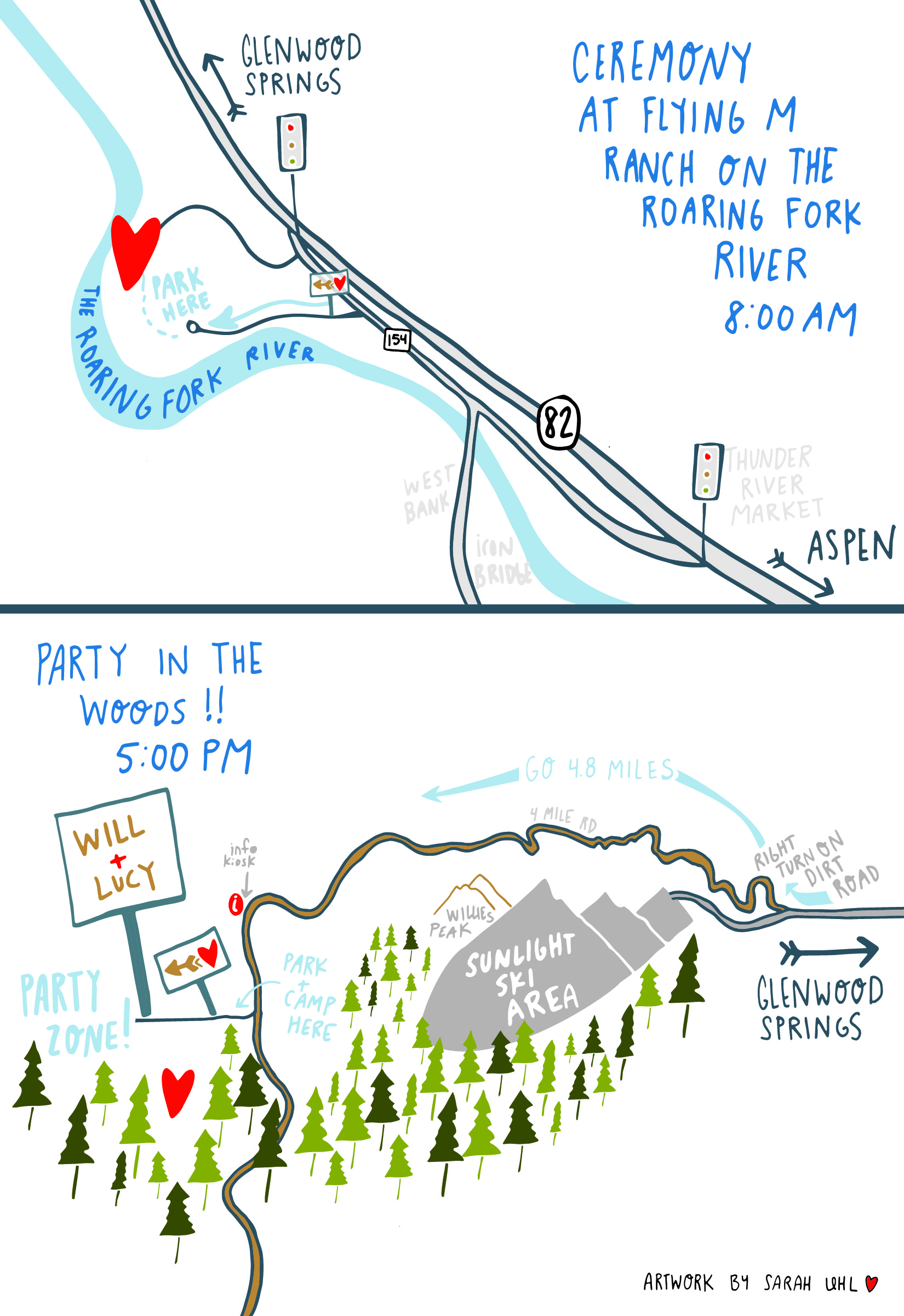
Wedding invite- venue information map!


Event Venue map for CAMPSIGHT in Breckenridge, Colorado
